I remember my first time on Mt. Hood. As a skier, I had always heard stories of the majestic Rockies in the US’s west, or of the Tahoe Valley in California. The Cascades in the Northwest felt ignored in comparison.
Riding up the Palmer lift at Mt. Hood’s Timberline Ski Resort, however, I was in awe. The base of the Mountain, and the other, smaller peaks of the Cascades, looked a world away. More than a mile below, as I would later find out. My first time on Mt. Hood was, in many ways, the most extraordinary outdoor experience of my life. Mt. Hood’s elevation is such that the top of the mountain is covered by a permanent glacier. This makes skiing in the summer possible. There’s nothing quite like standing up on a glacier and looking down at the lush, evergreen rain forest below.
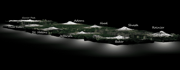
Ostensibly smaller, more rugged mountains, the Cascades indeed are generally at a lower elevation than Colorado Rockies or the Sierra Nevada. However, in terms vertical rise—which, for the purpose of this post, I’ll define as the delta between a mountain’s base and peak elevation, a handful of volcanic peaks in the Cascades are much larger. These true differences in size are often non-obvious when looking at statistics; I decided I would compare the mountains visually.
The Mountains
In my mind, these nine volcanoes are the most iconic in the Cascade range. Here are their respective elevations:
| Name | Elevation | State |
|---|---|---|
| Rainier | 14,411′ | Washington |
| Shasta | 14,179′ | California |
| Adams | 12,280′ | Washington |
| Hood | 11,250′ | Oregon |
| Baker | 10,778′ | Washington |
| Glacier Peak | 10,541′ | Washington |
| Jefferson* | 10,495′ | Oregon |
| St. Helens | 8,366′ (Before Eruption: 9,677) | Washington |
| Three Sisters | 9,633′ | Oregon |
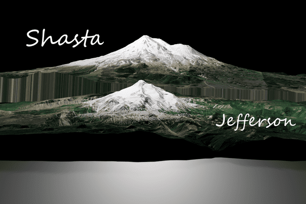
A few things to note when looking at these figures. Firstly, as alluded to in the introduction, elevation is not necessarily the most relevant metric when comparing mountains head-to-head. Looking at this chart, for example, we might think that Mt. Jefferson is close to the size of Mt. Shasta. In reality, that is not the case.
Shasta vs. Jefferson
When comparing the two directly, we note that Mt. Shasta appears twice as large as Mt. Jefferson, despite only having a ~40% relative increase in elevation. This is because the vertical rise of Shasta (nearly 10,000 feet) is nearly double that of Jefferson (~1 mile, or 5000 feet) In other words, because the base topography around Jefferson is at a higher elevation than the equivalent land around Shasta, Jefferson appears shorter in person. We see a similar, more nuanced comparison when looking at Shasta and Rainier, the two largest mountains in the range.
Shasta / Rainier
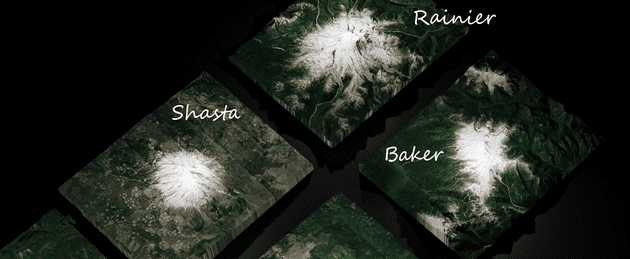
When viewed from the sky, Shasta appears a much smaller mountain than Rainier. In reality, Rainier is larger; but the difference is not dramatic.
Comparing the Mountains side-by-side, we see that Rainier has a significantly lower snow-line than Shasta. This is because of the formers significantly more northerly latitude. Rainier, in addition to being slightly larger, has more robust glacial cover.
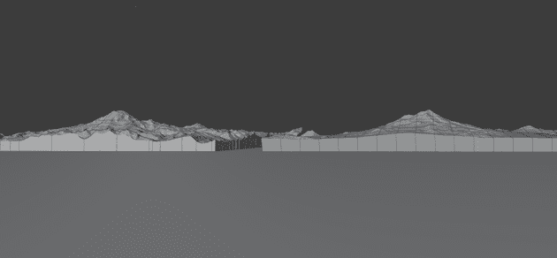
The similarity in size is made more obvious when viewing the two mountains without texturing. This reduces the visual weight of Rainier’s extensive glacier.
Hood and Adams
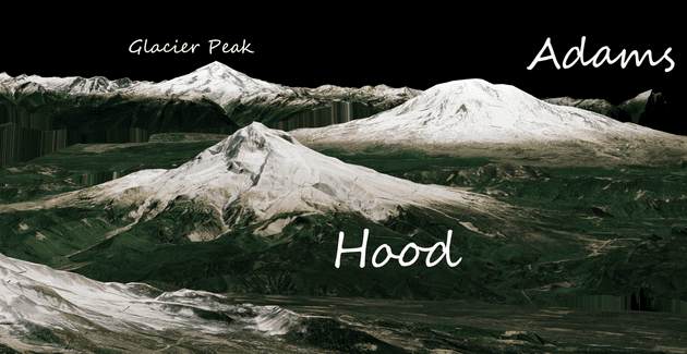
The difference between Mt. Hood and Mt. Adams is similarly captivating. While the two mountains are nearly equal differ only by 1,000′ in peak elevation, Adams appears more massive. This is in large part due to the shape of the volcano. Adams is significantly more bulbus in shape. Mt Hood is much leaner, and (in my opinion) more iconic looking.
Three Sisters and Adams
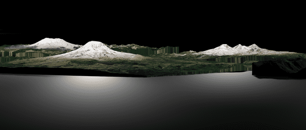
I think the size of Three Sisters, near Bend, OR are sometimes underestimated. When placed next to to Mt. Adams (center left), Three Sisters holds its own. South Sister (the leftmost peak of Three Sisters) roughly the same vertical rise as Mt. Jefferson.
All from Above
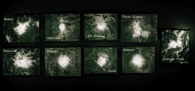
When viewed from above, the mountains display impressive variation in surface area, topography, and climate. As we travel further south—from Rainier to Shasta—we can see the forest grow less vibrant. The fallout from Mt. St. Helen’s 1980 eruption is still clearly visible four decades later. The difference in topography between Glacier Peak and the rest of the Cascade volcanos is also evident. Glacier Peak is surrounded by large mountains—the other peaks stand relatively on their own.
Closing
The Cascade volcanos are one of the defining features of the American West. They vary in terms of topography, size and vertical rise. By placing them side by side, we get a better sense of their true relative size than numbers can provide
So what if we compare Rainier to Telluride, one of the larger resorts in Colorado?
Rainier is larger, there’s no doubt. That said, the average mountain in Colorado is larger than the average peak in the Cascades, as these images suggest.
